
Section 1. What is our area like today?
Children should learn:
- that a map is a representation of an area
- to recognise some features in the local area, and to locate them on a map
- that an area may contain a mixture of old and new buildings
Activities
Prepare a large simplified map of the area, with a picture of the school as its central point, and collect photographs of nearby buildings or features that the children will recognise.
Ask the children what they know about the area and mark on street names.
Put the photographs in their correct places on the map.
Use the pictures as a basis for an introductory discussion about how the buildings are used and who uses them. Ask the children to sort the buildings into ‘old’ or ‘new’, giving reasons for their choice. Use this as an opportunity to discuss what is meant by ‘old’.
Outcomes
Children
- identify features in their area on the large map
- use features of buildings to infer their use and who owned them
- categorise buildings as ‘old’ or ‘new’
Points to note
Identify an individual building or a group of buildings, such as a street or row of shops.
Select buildings which are easily and safely accessible from school, which will interest children, and which have a range of available supporting material for a particular date or dates in the past, eg old photographs, maps, newspaper cuttings.
· Queens Road Factory – When was it built? What is it used for now?
· Rileys Toffees Factory (competitor) Hopwood Lane – When was it built? What is it used for now?
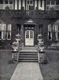
· Greystones – John and Violet Mackintosh’s home – research its current use – is it one house or flats? When was it built?
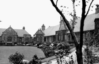
· Mackintosh Homes – When were they built? Now that Mackintosh’s doesn’t exist, who looks after them? Do people who live there have to be retired workers from Mackintosh’s?
Take photographs of local buildings, using digital technology if available.
Make sure they include a variety of different types of buildings that the children will recognise, eg shops, schools, churches, garages.
If possible, lay the large map out flat on the floor or on a table, rather than upright.
Remember when looking at ‘old’ and ‘new’ that some buildings are multi-period.
These activities have important connections with a geographical local study.
Information can be found on this website or some answers can be found on the trail, using your map.