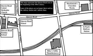
The map below represents the Queens Road area at the beginning of the 20th Century. The map may help you to imagine what the area would have been like and can also be used as part of the National Curriculum, History at key stages 1 and 2 (Year 3/4 )
Click on the image below to download a pdf of the map.
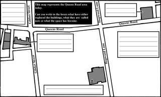
The map below represents the Queens Road area now. The map may help you to imagine what the area would have been like and can also be used as part of the National Curriculum, History at key stages 1 and 2 (Year 3/4)
Click on the image below to download a pdf of the map.